Hal Owen & Associates Inc., PO Box 400, Lillington, NC 27546
Stream and Wetland Services
Surface waters, such as streams and wetlands, provide several important ecological functions and are currently regulated under the authority of the Clean Water Act (CWA). Also, some riparian buffers adjacent to certain surface waters are regulated by state law or local ordinance.
HO&A has years of experience identifying these waters and preparing permit applications. All wetland determinations are conducted using the appropriate Regional Supplement of the 1987 US Army Corps of Engineers Wetland Delineation Manual. Stream determinations are made in accordance with the NC Division of Water Resources Methodology for Identification of Intermittent and Perennial Streams and their Origins.
Types of Stream and Wetland Investigations

Stream/Wetland Reconnaissance or Preliminary
This low-intensity evaluation consists of an existing documents review (published soil, topographic, and aerial maps) coupled with an on site investigation to determine the approximate location of potential streams and wetlands. A written report and sketch map are provided to the client. This level of investigation is more accurate than public GIS and may be used for general land planning.
- Potential wetlands are usually an over-estimation of actual wetlands on site
- Low-intensity investigation typically used by potential buyers or to verify streams or wetlands are not within project boundaries
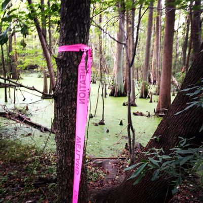
Stream/Wetland Delineation
Stream and wetland delineations may be needed as a site planning tool for development, to obtain permits to impact regulated waters or buffers, or to resolve violations.
A wetland delineation consists of marking the precise boundary between uplands and wetlands with consecutively numbered flags. The existence and extent of any streams that exist on the property will also be determined and flagged as needed. We will locate the flags using a submeter GPS and produce a map depicting the regulatory boundaries within the study area.
We may also collect site data necessary to submit the delineation to the US Army Corps of Engineers for concurrence. A site visit with agency personnel may be required to verify the delineation.
- High-intensity investigation
- Typically requested when impacts to regulated waters or buffers are anticipated or as information that local regulatory agencies request for development permits
Permitting Assistance: CWA Section 404 and 401, NC Riparian Buffers
When impacts to regulated waters or buffers can’t be avoided, then it's necessary to secure the appropriate permits through USACE and/or NCDWR. We assist clients through the application process by coordinating with the surveyor or engineer, filling out forms, consulting regulatory databases, compiling maps and documents, and contacting mitigation banks. After submitting the completed application, we coordinate with agency personnel to fulfill additional information requests.
- Efficient preparation of applications and supplemental documents
- We are advocates for your project and work diligently to achieve your goals
- We have an established rapport with regulators
Violation Resolution
Sometimes impacts happen before the proper permits are in place. If a violation has occurred, you may be faced with costly fines and restoration fees in addition to time delays on your project. We work on your behalf to resolve the violation as quickly as possible by responding to the agency requests for action. This usually includes delineating the original stream location or wetland boundary, preparing a permit application for after-the-fact authorization, and/or developing a restoration plan detailing the steps needed to return the damaged area to a more natural state.